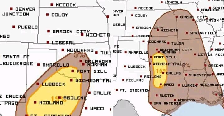
Residents across western Texas and the Dallas-Fort Worth (DFW) area should brace for a turbulent night as severe storms sweep through the region. The National Weather Service warns of scattered gusts reaching up to 60 mph, hail up to one inch in diameter, and the potential for a few tornadoes.
Storm activity is expected to kick off in north and northwest Texas between 9 PM and midnight tonight, with isolated severe cells forming before a more organized squall line develops. By just after midnight, this squall line will race eastward out of western Texas, bringing the most intense weather to the DFW area between 4 AM and 8 AM Monday morning.
The primary hazards in the squall line include powerful straight-line winds and embedded tornadoes, which could develop quickly with little warning. While the storms will gradually weaken as they approach the Texas-Louisiana border later in the morning, eastern parts of Texas are still advised to monitor conditions. Forecasters estimate only a marginal 5% risk of severe weather in this area.
Residents in the affected regions should secure outdoor items, avoid travel during the storm, and have a reliable way to receive weather alerts overnight. Tornado warnings, if issued, will require immediate action to seek shelter in a sturdy building or interior room.
Stay alert, Texas, as these storms could pack a punch while many are asleep. Keep your weather radios and alert systems handy to ensure you and your family stay safe during the early-morning hours.


